
Mercator projection
A conformal cylindrical map projection devised by Gerardus Mercator in 1569, which draws constant-bearing routes as straight lines.
- Year
- 1569
- People involved
- Gerardus Mercator
- Section
- Earth sciences
History
The Mercator projection is a method for drawing the Earth's surface on a flat plane. Its key advantage is that a route of constant bearing, one that keeps the same angle to north, appears as a straight line. This made it very useful for plotting courses at sea, though at the cost of distorting areas, especially near the poles.
Before Mercator, sailors used portolan charts, drawn with networks of lines showing directions, but with no defined mathematical projection. In 1537 the Portuguese mathematician Pedro Nunes described the principle of the rhumb line, the path of constant bearing, and proposed a nautical atlas made of large-scale sheets. If those sheets were assembled at the same scale, they would approximate what later became the Mercator projection. Mercator was likely helped by his friendship with Nunes and his access to Nunes's tables, though he never explained how he arrived at his method.
In 1569 the Flemish geographer and mapmaker Gerardus Mercator, born Gerhard Kremer, published a large world map printed on eighteen separate sheets. Its title, roughly "A new and augmented description of the Earth corrected for the use of sailors", makes clear that he meant it for navigation. The idea is to stretch the meridians apart as if the globe were wrapped in a cylinder touching it along the equator, and to stretch the parallels by the same proportion so that angles are preserved. The scale therefore grows with latitude and becomes infinite at the poles, so the map can never show the polar regions fully.
The method was not adopted at once. Edward Wright published the first accurate construction tables in 1599 and again in 1610, and the first mathematical formulation appeared around 1645 through Henry Bond, although Thomas Harriot had developed the mathematics around 1589 without publishing it. In the eighteenth century, after the marine chronometer was invented and the distribution of magnetic declination was understood, navigators could fully adopt it. In the nineteenth century it became the common map in many atlases and school maps, but its distortions drew steady criticism. Cartographers pointed out that it inflates Greenland, Alaska and Antarctica compared with regions near the equator, and most modern atlases have dropped it for world maps in favour of equal-area projections.
Its role has nonetheless returned. Web mapping services such as Google Maps, OpenStreetMap and Bing Maps use a variant that treats the Earth as a sphere, which simplifies the calculations. Its developers highlight that north and south always appear vertical and that, being conformal, building shapes are not distorted. Nautical charts still use it, and its combination of straight bearings and faithful angles keeps it in everyday use today.
Timeline
- 1537Pedro Nunes describes the rhumb line and proposes a nautical atlas of large-scale sheets.
- 1569Gerardus Mercator publishes his large eighteen-sheet world map, designed for sailors.
- 1599Edward Wright publishes the first accurate tables for constructing the projection.
- 1610Wright expands his explanation in the treatise Certaine Errors in Navigation.
- 1645Around this date Henry Bond publishes the first mathematical formulation.
- 1800In the eighteenth century, with the marine chronometer, the projection is fully adopted for navigation.
- 2005Google Satellite Maps leaves the equidistant projection and moves to a Mercator variant.
Trivia and anecdotes
A map for sailors
The title of the 1569 map itself shows that Mercator designed it for sailors, not as an atlas decoration.
Disputed origins
Earlier origins have been claimed for Chinese charts and Etzlaub's maps, but the evidence is disputed and inconclusive.
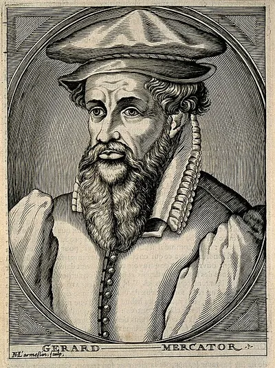 Gerardus Mercator1512–1594 · Mathematics
